Advanced Surface Water Hydrology & Flood Risk Analysis
Our surface water modeling services provide water resource engineers, urban planners, and disaster management agencies with precise tools for watershed analysis, flood prediction, and hydraulic infrastructure design. We combine hydrological science with cutting-edge modeling technology to create resilient water management solutions.
Hydrological Modeling
Rainfall-runoff analysis and streamflow simulationFlood Inundation Mapping
High-resolution flood extent and depth predictionCore Modeling Services
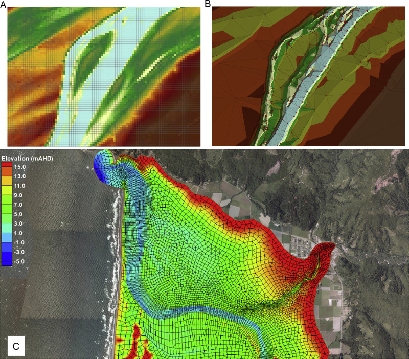
Watershed Characterization
Delineation and parameterization of drainage basins
Hydraulic Structure Analysis
Modeling bridges, culverts, and stormwater systems
Urban Stormwater Modeling
Drainage network analysis for flood mitigation
Climate Change Adaptation
Extreme event modeling under future climate scenarios
Our Modeling Process
Watershed Inventory
Topography, land use, soil data, rainfall records, and stream gauge measurements
System Configuration
Watershed delineation, parameter estimation, and boundary conditions
Historical Validation
Adjusting model parameters to match observed streamflow events
Design Simulations
Testing various rainfall events, development scenarios, and mitigation options
Flood Hazard Delineation
Generating inundation maps for different return period events
Technical Specifications
Modeling Software
- HEC-HMS (Hydrologic Modeling)
- HEC-RAS (Hydraulic Analysis)
- SWMM (Stormwater Systems)
- MIKE SHE (Integrated Modeling)
Data Requirements
- LiDAR/DEM (1m-5m resolution)
- Rainfall intensity-duration data
- Stream cross-sections
- Land use/soil maps
Deliverables
- Flood hazard maps
- Design hydrographs
- Infrastructure capacity analysis
- Interactive web viewers
Modeling Standards
Compliant with FEMA guidelines, state floodplain regulations, and ISO requirements
Flood Risk Assessment
Evaluate your community's vulnerability to surface water flooding.
Request Watershed Analysis

